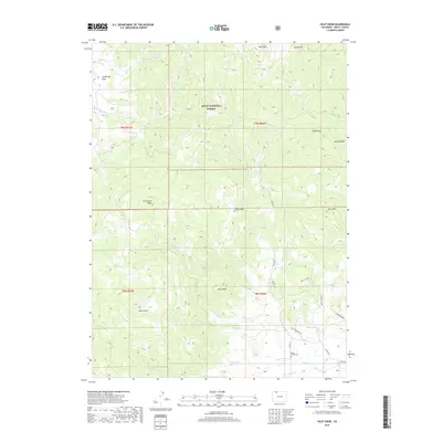
2019 Map of Pilot Knob
USGS Topo · Published 2019About this map
Routt National Forest dominates this section of the Colorado high country, where the landscape is defined by a series of prominent peaks and dramatic geological formations. The eponymous Pilot Knob and the nearby Round Mtn stand as landmarks above a complex network of drainages including Armstrong Cr and Deep Cr. Evidence of the area's geological variety is found in labels like Anthracite Ridge and the Devils Slide, while California Park indicates a distinct meadow or opening within the timbered slopes. Along the southern edge of the quadrangle, human presence is marked by the Deep Creek Cem and a small network of rural roads such as Smith Creek Rd and Aspen Meadows Ln. The map illustrates a transitional zone where high ridges like Rim Rocks and Buck Mtn drop down toward the creek valleys, providing a detailed view of the forest's topographic character.
Find a feature on this map
35 named features on this map. Tap any name to fly to it.
Don’t see what you’re looking for? This feature index may not catch every label — zoom into the map to look around manually.
Map Details
Editions of this 2019 Pilot Knob Map
This is the sole edition of this map. No revisions or reprints were ever made.
Other maps of this area

1911 · Hahns Peak
USGS Topo · 1:125,000

1913 · Hahns Peak
USGS Topo · 1:125,000

1923 · Pilot Knob
USGS Topo · 1:62,500

1925 · Pilot Knob
USGS Topo · 1:62,500

1954 · Craig
USGS Topo · 1:250,000

1957 · Craig
USGS Topo · 1:250,000

1958 · Craig
USGS Topo · 1:250,000

1960 · Craig
USGS Topo · 1:250,000

1962 · Craig
USGS Topo · 1:250,000
1962 · Hahns Peak
USGS Topo · 1:24,000