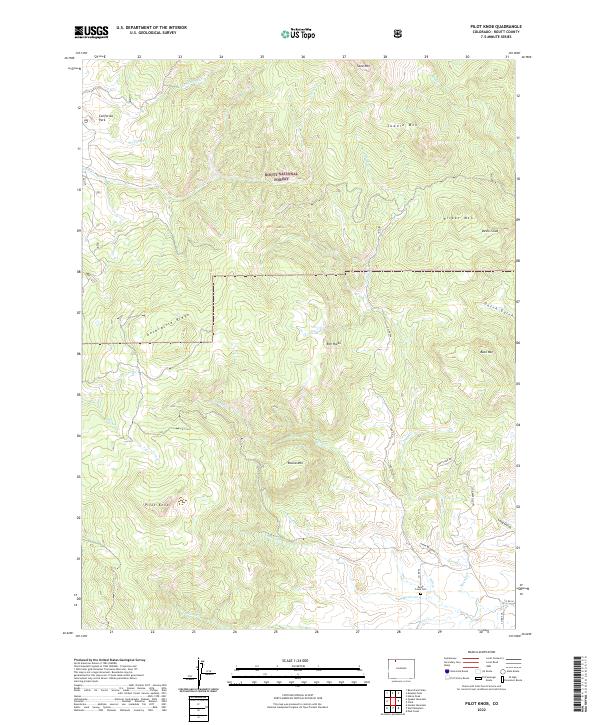
2022 Map of Pilot Knob
USGS Topo · Published 2022About this map
Routt National Forest dominates this section of the Colorado landscape, where high-altitude ridges and watercourses define the settlement patterns. The map highlights significant topographical features like the Anthracite Ridge and the Devils Slide, which tower over the creek systems. For those tracing local heritage, the Deep Creek Cem in the southern portion of the quadrangle serves as a vital point of reference for early inhabitants.
Find a feature on this map
37 named features on this map. Tap any name to fly to it.
Don’t see what you’re looking for? This feature index may not catch every label — zoom into the map to look around manually.
Map Details
Editions of this 2022 Pilot Knob Map
This is the sole edition of this map. No revisions or reprints were ever made.
Other maps of this area

1911 · Hahns Peak
USGS Topo · 1:125,000

1913 · Hahns Peak
USGS Topo · 1:125,000

1923 · Pilot Knob
USGS Topo · 1:62,500

1925 · Pilot Knob
USGS Topo · 1:62,500

1954 · Craig
USGS Topo · 1:250,000

1957 · Craig
USGS Topo · 1:250,000

1958 · Craig
USGS Topo · 1:250,000

1960 · Craig
USGS Topo · 1:250,000

1962 · Craig
USGS Topo · 1:250,000
1962 · Hahns Peak
USGS Topo · 1:24,000