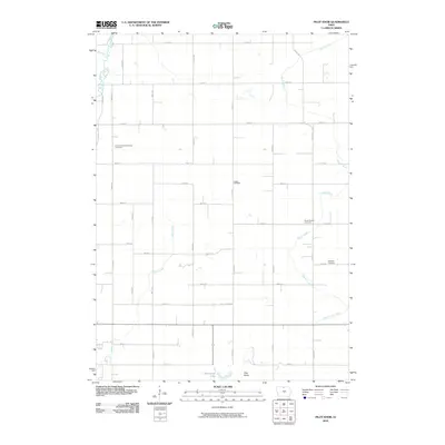
2010 Map of Pilot Knob
USGS Topo · Published 2010About this map
Pilot Knob and the nearby Pilot Knob Lake anchor this 2010 topographic survey of the landscape northeast of Forest City. The terrain is defined by a grid of rural section roads and a complex network of waterways, including the Winnebago River, Beaver Creek, and Bear Creek. The map provides significant genealogical value for researchers, as it precisely locates several burial grounds across the township, such as Mount Valley Township Cemetery, Union Cemetery, South Bethel Cemetery, and Kingland Cemetery. The presence of Drainage Ditch No 52 in the southeast corner reflects the engineered nature of the regional drainage system, essential for the surrounding agricultural environment. Small water features like Pike Run and Lime Creek further detail the hydrology of this northern Iowa landscape during the early 21st century.
Find a feature on this map
36 named features on this map. Tap any name to fly to it.
Don’t see what you’re looking for? This feature index may not catch every label — zoom into the map to look around manually.
Map Details
Editions of this 2010 Pilot Knob Map
This is the sole edition of this map. No revisions or reprints were ever made.
Other maps of this area

1954 · Mason City
USGS Topo · 1:250,000

1957 · Mason City
USGS Topo · 1:250,000

1958 · Mason City
USGS Topo · 1:250,000

1972 · Clear Lake West
USGS Topo · 1:24,000

1972 · Forest City
USGS Topo · 1:24,000

1972 · Fertile
USGS Topo · 1:24,000

1972 · Hayfield
USGS Topo · 1:24,000

1972 · Bristol
USGS Topo · 1:24,000

1972 · Pilot Knob
USGS Topo · 1:24,000

1972 · Vinje
USGS Topo · 1:24,000