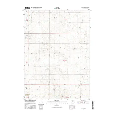
2015 Map of Pilot Knob
USGS Topo · Published 2015About this map
The Winnebago River meanders through the northwest corner of this Winnebago County landscape, anchoring a region defined by agricultural sections and scattered rural landmarks. Near the northern boundary, the settlement of Leland sits along the road network, while the northern edge of Forest City occupies the southwest, separated from the hills by the course of Bear Cr. This area is particularly rich for genealogical study, preserving the locations of several burial grounds including Mount Valley Township Cem, Union Cem, South Bethel Cem, and Kingland Cem. In the south, the terrain rises toward the glacial features of Pilot Knob, where Pilot Knob Lake is situated. The mapping detail also highlights the early engineering of the water table, notably Drainage Ditch Number 54 and the various tributaries of Beaver Cr that crisscross the prairie.
Find a feature on this map
37 named features on this map. Tap any name to fly to it.
Don’t see what you’re looking for? This feature index may not catch every label — zoom into the map to look around manually.
Map Details
Editions of this 2015 Pilot Knob Map
This is the sole edition of this map. No revisions or reprints were ever made.
Other maps of this area

1954 · Mason City
USGS Topo · 1:250,000

1957 · Mason City
USGS Topo · 1:250,000

1958 · Mason City
USGS Topo · 1:250,000

1972 · Clear Lake West
USGS Topo · 1:24,000

1972 · Forest City
USGS Topo · 1:24,000

1972 · Fertile
USGS Topo · 1:24,000

1972 · Hayfield
USGS Topo · 1:24,000

1972 · Bristol
USGS Topo · 1:24,000

1972 · Pilot Knob
USGS Topo · 1:24,000

1972 · Vinje
USGS Topo · 1:24,000