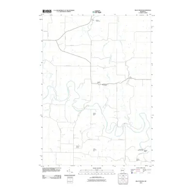
2010 Map of Pilot Mound
USGS Topo · Published 2010About this map
The meandering Root River carves a complex path through this corner of Winona County, defining a landscape where agriculture and water management are deeply entwined. Small settlements like Troy and Pilot Mound anchor the rural road network, while smaller locales such as Bucksnort and Wadden Valley appear as quiet clusters along the valley floor. The map is particularly notable for its high concentration of small-scale water control features, including the Stanley Harcey Dam, Lagoon Park Dam, and the T Rain Structure Dam, reflecting a concerted effort to manage the drainage of the Trout Run and Money Creek watersheds.
Find a feature on this map
27 named features on this map. Tap any name to fly to it.
Don’t see what you’re looking for? This feature index may not catch every label — zoom into the map to look around manually.
Map Details
Editions of this 2010 Pilot Mound Map
This is the sole edition of this map. No revisions or reprints were ever made.
Other maps of this area

1954 · Chatfield
USGS Topo · 1:62,500

1954 · Lewiston
USGS Topo · 1:62,500

1954 · Mason City
USGS Topo · 1:250,000

1957 · Mason City
USGS Topo · 1:250,000

1958 · Mason City
USGS Topo · 1:250,000

1958 · La Crosse
USGS Topo · 1:250,000

1961 · La Crosse
USGS Topo · 1:250,000

1965 · La Crosse
USGS Topo · 1:250,000
1965 · Lanesboro
USGS Topo · 1:24,000

1965 · Fountain
USGS Topo · 1:24,000