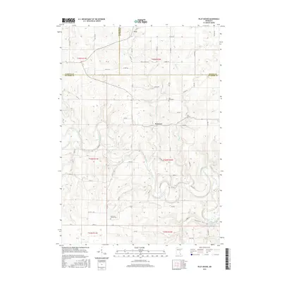
2016 Map of Pilot Mound
USGS Topo · Published 2016About this map
Troy and Bucksnort anchor this survey of the driftless-style terrain at the intersection of Winona, Fillmore, and Olmsted counties. The landscape is defined by the deep winding valleys of the Root River and its tributaries, including Trout Run and Money Creek. The map documents a rural agricultural community where historical land use is marked by sites like the Root Prairie Lutheran Cem and Pilot Mound Cem. The terrain rises toward the namesake Pilot Mound landmark, while the southern portion of the quadrangle follows the broad Wadden Valley toward the North Branch Root River Reservoir. This modern topographic study shows the persistent rural road network, from Co HWY 6 to isolated tracks like Hook Ln, tracing the narrow ridges and fertile valley floors that have dictated settlement patterns for generations.
Find a feature on this map
64 named features on this map. Tap any name to fly to it.
Don’t see what you’re looking for? This feature index may not catch every label — zoom into the map to look around manually.
Map Details
Editions of this 2016 Pilot Mound Map
This is the sole edition of this map. No revisions or reprints were ever made.
Other maps of this area

1954 · Chatfield
USGS Topo · 1:62,500

1954 · Lewiston
USGS Topo · 1:62,500

1954 · Mason City
USGS Topo · 1:250,000

1957 · Mason City
USGS Topo · 1:250,000

1958 · Mason City
USGS Topo · 1:250,000

1958 · La Crosse
USGS Topo · 1:250,000

1961 · La Crosse
USGS Topo · 1:250,000

1965 · La Crosse
USGS Topo · 1:250,000
1965 · Lanesboro
USGS Topo · 1:24,000

1965 · Fountain
USGS Topo · 1:24,000