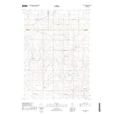
2019 Map of Pilot Mound
USGS Topo · Published 2019About this map
The winding Root River carves a deep path through the driftless-style terrain of southeastern Minnesota, where the borders of Olmsted, Winona, and Fillmore counties meet. Small named settlements like Troy and Bucksnort anchor the rural landscape, which is defined by high ridges and dendritic stream networks including Trout Run and Money Cr. The namesake Pilot Mound landmark stands as a prominent elevation point overlooking the valley below, serving as a geographic anchor for the surrounding township.
Find a feature on this map
72 named features on this map. Tap any name to fly to it.
Don’t see what you’re looking for? This feature index may not catch every label — zoom into the map to look around manually.
Map Details
Editions of this 2019 Pilot Mound Map
This is the sole edition of this map. No revisions or reprints were ever made.
Other maps of this area

1954 · Chatfield
USGS Topo · 1:62,500

1954 · Lewiston
USGS Topo · 1:62,500

1954 · Mason City
USGS Topo · 1:250,000

1957 · Mason City
USGS Topo · 1:250,000

1958 · Mason City
USGS Topo · 1:250,000

1958 · La Crosse
USGS Topo · 1:250,000

1961 · La Crosse
USGS Topo · 1:250,000

1965 · La Crosse
USGS Topo · 1:250,000
1965 · Lanesboro
USGS Topo · 1:24,000

1965 · Fountain
USGS Topo · 1:24,000