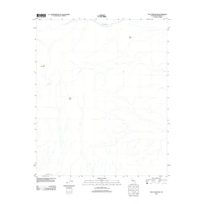
2012 Map of Pilot Mountain
USGS Topo · Published 2012About this map
Pilot Mountain and the surrounding Riverside County desert are defined by dramatic relief and ephemeral watercourses in this 2012 survey. The landscape is anchored by high points such as Sharp Peak and Black Butte, which overlook a network of seasonal drainages including Corn Springs Wash and Ship Cr. Transportation in this arid environment follows established corridors like Corn Springs Rd in the north and the historic The Bradshaw Trl along the southern margin. The distribution of these features illustrates a region where topography and water scarcity dictate movement, with name-bearing peaks serving as vital landmarks for navigation across the basin and range terrain.
Find a feature on this map
7 named features on this map. Tap any name to fly to it.
Don’t see what you’re looking for? This feature index may not catch every label — zoom into the map to look around manually.
Map Details
Editions of this 2012 Pilot Mountain Map
This is the sole edition of this map. No revisions or reprints were ever made.
Other maps of this area

1940 · Iris Pass
USGS Topo · 1:62,500

1944 · Chuckwalla Mountains
USGS Topo · 1:62,500

1945 · Iris Pass
USGS Topo · 1:62,500

1952 · Sidewinder Well
USGS Topo · 1:62,500

1953 · Chuckwalla Spring
USGS Topo · 1:62,500

1954 · Salton Sea
USGS Topo · 1:250,000

1955 · Salton Sea
USGS Topo · 1:250,000

1959 · Salton Sea
USGS Topo · 1:250,000

1963 · Salton Sea
USGS Topo · 1:250,000
1963 · Iris Pass
USGS Topo · 1:62,500