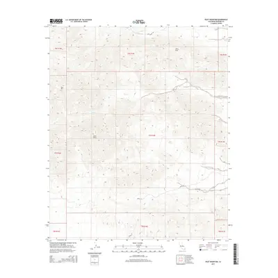
2015 Map of Pilot Mountain
USGS Topo · Published 2015About this map
Pilot Mtn and Sharp Peak anchor this desert landscape within the Colorado Desert of Riverside County. This 2015 survey reveals a terrain defined by high summits and deep drainage channels, where seasonal water follows paths like Corn Springs Wash and Ship Cr. The map preserves the network of backcountry routes, specifically Corn Springs Rd in the north and Dupont Rd winding through the southern reaches. These roads provide the primary access through the townships, which are largely characterized by the significant elevation changes between the peaks and the surrounding basins. A prominent landmark in the central portion of the sheet, Black Butte stands as a distinct topographical feature amidst the intricate contour lines of this arid region.
Find a feature on this map
16 named features on this map. Tap any name to fly to it.
Don’t see what you’re looking for? This feature index may not catch every label — zoom into the map to look around manually.
Map Details
Editions of this 2015 Pilot Mountain Map
This is the sole edition of this map. No revisions or reprints were ever made.
Other maps of this area

1940 · Iris Pass
USGS Topo · 1:62,500

1944 · Chuckwalla Mountains
USGS Topo · 1:62,500

1945 · Iris Pass
USGS Topo · 1:62,500

1952 · Sidewinder Well
USGS Topo · 1:62,500

1953 · Chuckwalla Spring
USGS Topo · 1:62,500

1954 · Salton Sea
USGS Topo · 1:250,000

1955 · Salton Sea
USGS Topo · 1:250,000

1959 · Salton Sea
USGS Topo · 1:250,000

1963 · Salton Sea
USGS Topo · 1:250,000
1963 · Iris Pass
USGS Topo · 1:62,500