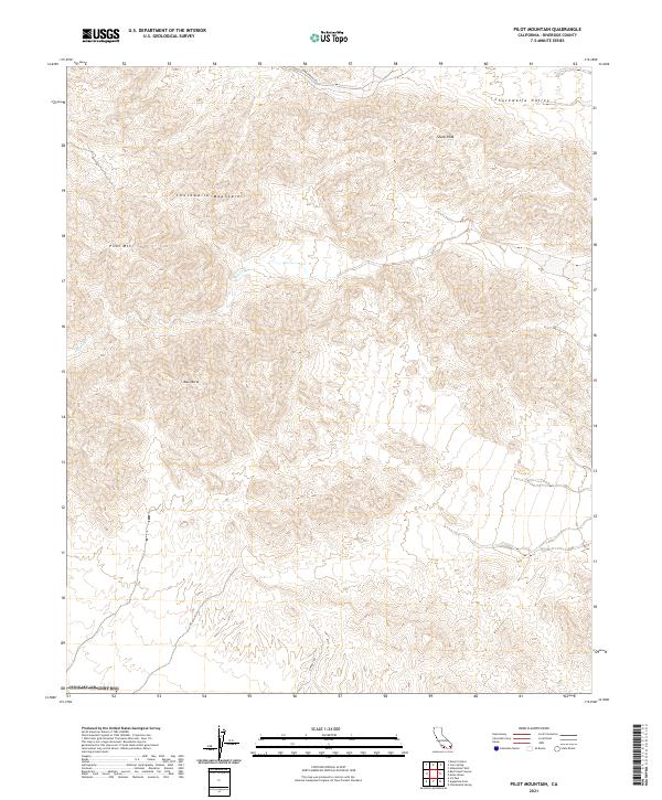
2021 Map of Pilot Mountain
USGS Topo · Published 2021About this map
Chuckwalla Mountains terrain dominates this Riverside County landscape, where the high desert is defined by a series of prominent peaks and drainage systems. The survey is anchored by Pilot Mtn, a significant landmark rising above the western reach of the map, while Black Butte and Sharp Peak mark the central and northeastern ridges respectively. This arid environment is drained by the seasonal Ship Cr, which cuts through the mountains toward the broader Chuckwalla Valley in the north. Human presence is limited to isolated backcountry routes like Corn Springs Rd and Dupont Rd, which traverse the desert floor. The map highlights the vast, undeveloped character of the California desert before more modern infrastructure or solar developments reached this specific interior region of the range.
Find a feature on this map
17 named features on this map. Tap any name to fly to it.
Don’t see what you’re looking for? This feature index may not catch every label — zoom into the map to look around manually.
Map Details
Editions of this 2021 Pilot Mountain Map
This is the sole edition of this map. No revisions or reprints were ever made.
Other maps of this area

1940 · Iris Pass
USGS Topo · 1:62,500

1944 · Chuckwalla Mountains
USGS Topo · 1:62,500

1945 · Iris Pass
USGS Topo · 1:62,500

1952 · Sidewinder Well
USGS Topo · 1:62,500

1953 · Chuckwalla Spring
USGS Topo · 1:62,500

1954 · Salton Sea
USGS Topo · 1:250,000

1955 · Salton Sea
USGS Topo · 1:250,000

1959 · Salton Sea
USGS Topo · 1:250,000

1963 · Salton Sea
USGS Topo · 1:250,000
1963 · Iris Pass
USGS Topo · 1:62,500