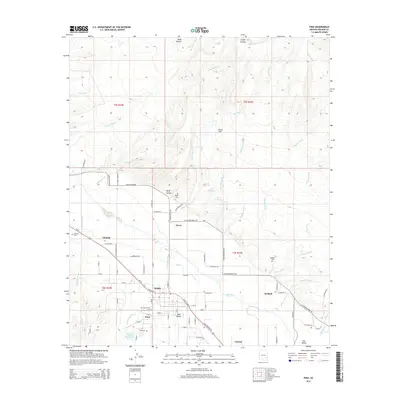
2014 Map of Pima
USGS Topo · Published 2014About this map
The Gila River valley serves as the central artery for this agricultural landscape, where the Graham Canal manages water distribution across the lowlands. Settlements like Pima, Bryce, Glenbar, and Kimball are concentrated along the river corridor, supported by a network of drainage washes including Markham Wash and Cottonwood Wash. For those researching family history, this 2014 survey records numerous local burial sites including Pima Cem, Bryce Cem, Glenbar Cem, Hubbard Cem, and Rogers Cem, often located near their respective namesake communities. The north-south contrast between the irrigated valley floor and the arid terrain of Rocky Flat and Wide Hollow illustrates the region's reliance on the Gila River system for settlement and industry.
Find a feature on this map
89 named features on this map. Tap any name to fly to it.
Don’t see what you’re looking for? This feature index may not catch every label — zoom into the map to look around manually.
Map Details
Editions of this 2014 Pima Map
This is the sole edition of this map. No revisions or reprints were ever made.
Other maps of this area

1954 · Silver City
USGS Topo · 1:250,000

1954 · Clifton
USGS Topo · 1:250,000

1957 · Clifton
USGS Topo · 1:250,000

1958 · Silver City
USGS Topo · 1:250,000

1958 · Clifton
USGS Topo · 1:250,000

1960 · Thatcher
USGS Topo · 1:62,500

1960 · Fort Thomas
USGS Topo · 1:62,500

1960 · Safford
USGS Topo · 1:62,500

1962 · Silver City
USGS Topo · 1:250,000

1962 · Clifton
USGS Topo · 1:250,000