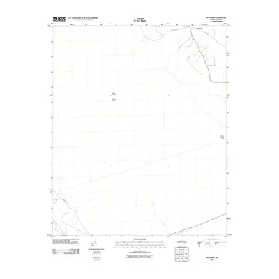
2010 Map of Pin Hook
USGS Topo · Published 2010About this map
The settlement of Pin Hook anchors the northern reaches of this coastal plain landscape in Duplin County. Defined by low-lying wetlands and subtle elevations like Blue Ridge and Long Straw Ridge, the area exhibits a quiet rural character at the turn of the decade. The Blue Ridge Airfield serves as a distinct landmark in the central portion of the quadrangle, while the southern landscape is shaped by the winding course of the Northeast Cape Fear River and the waters of Mill Pond. A network of local routes, including Croomsbridge Rd, Lawton Rd, and Angola Bay Rd, provides the primary infrastructure connecting these scattered communities and geographic features. The map illustrates a region where water and terrain dictate the slow pace of development, preserving a snapshot of eastern North Carolina's rural topography.
Find a feature on this map
11 named features on this map. Tap any name to fly to it.
Don’t see what you’re looking for? This feature index may not catch every label — zoom into the map to look around manually.
Map Details
Editions of this 2010 Pin Hook Map
This is the sole edition of this map. No revisions or reprints were ever made.
Other maps of this area

1942 · Burgaw
USGS Topo · 1:62,500

1943 · Kenansville
USGS Topo · 1:62,500

1948 · Kenansville
USGS Topo · 1:62,500

1948 · Maple Hill
USGS Topo · 1:62,500

1948 · Richlands
USGS Topo · 1:62,500

1953 · Beaufort
USGS Topo · 1:250,000

1954 · Beaufort
USGS Topo · 1:250,000

1965 · Richlands
USGS Topo · 1:62,500

1972 · Beaufort
USGS Topo · 1:250,000
1980 · Richlands
USGS Topo · 1:62,500