1962 Map of Pine Bluff
USGS Topo · Published 1973About this map
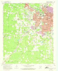
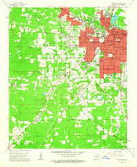
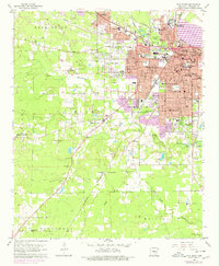
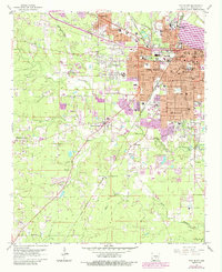
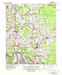
Pine Bluff is depicted during a period of significant growth and institutional development in the early 1960s, with later updates tracking its urban expansion. The city is the clear focal point, showing the concentrated footprint of the Arkansas Mechanical and Normal College and the St Louis Southwestern rail lines. The landscape south of the city center is defined by the winding course of Bayou Bartholomew and the smaller Nevins Creek, which cut through the townships of Niven and Vaughine. The map reveals a high density of educational and religious sites, such as the Arkansas Industrial Sch and St Andrews Ch, which speak to the civic structure of the era. To the west and south, the transition from urban streets to rural areas is marked by clusters like Watson Chapel and Sulphur Springs, alongside numerous gravel pits and sections of an abandoned pipeline corridor.
Find a feature on this map
72 named features on this map. Tap any name to fly to it.
Don’t see what you’re looking for? This feature index may not catch every label — zoom into the map to look around manually.
Map Details
Editions of this 1962 Pine Bluff Map
4 editions found
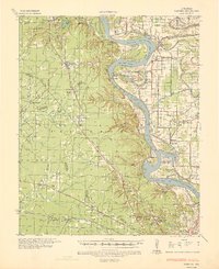
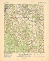
Other maps of this area

1932 · Pastoria
USGS Topo · 1:62,500
1935 · Altheimer
USGS Topo · 1:62,500
1935 · Pastoria
USGS Topo · 1:62,500
1935 · Noble Lake
USGS Topo · 1:62,500

1948 · Helena
USGS Topo · 1:250,000

1950 · Helena
USGS Topo · 1:250,000

1955 · Helena
USGS Topo · 1:250,000

1955 · Little Rock
USGS Topo · 1:250,000

1956 · Little Rock
USGS Topo · 1:250,000

1959 · Helena
USGS Topo · 1:250,000