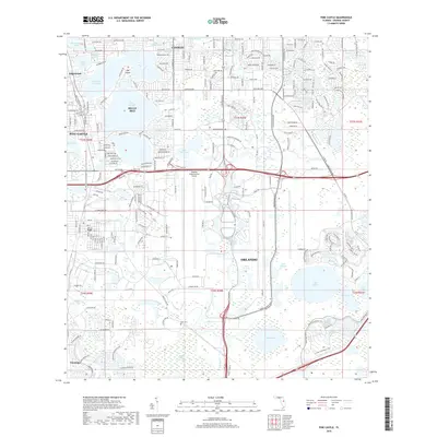
2018 Map of Pine Castle
USGS Topo · Published 2018About this map
Lake Conway and its interconnected waterways, including Little Lake Conway and Lake Gatlin, define the residential character of the Belle Isle and Edgewood areas. This 2018 survey documents the intricate suburban expansion south of Orlando, where established communities like Pine Castle and the older grid of Taft sit alongside the expansive footprint of the Orlando International Airport. A notable contrast exists between the densely settled northern half and the southern reaches, where the landscape transitions into the Boggy Creek Swamp and the wetlands around Mud Lake and Bull Slough. Genealogists and local historians can locate the Lock Cem situated near the headwaters of Boggy Creek, a quiet landmark amidst the region's rapid development. The map also traces modern growth around Lake Nona, reflecting the ongoing transformation of the Mare Prairie area.
Find a feature on this map
215 named features on this map. Tap any name to fly to it.
Don’t see what you’re looking for? This feature index may not catch every label — zoom into the map to look around manually.
Map Details
Editions of this 2018 Pine Castle Map
This is the sole edition of this map. No revisions or reprints were ever made.
Other maps of this area

1953 · Lake Jessamine
USGS Topo · 1:24,000

1953 · St Cloud North
USGS Topo · 1:24,000

1953 · Narcoossee
USGS Topo · 1:24,000

1953 · Pine Castle
USGS Topo · 1:24,000

1953 · Kissimmee
USGS Topo · 1:24,000

1953 · Oviedo SW
USGS Topo · 1:24,000

1953 · Narcoossee NW
USGS Topo · 1:24,000

1955 · Orlando
USGS Topo · 1:250,000

1956 · Orlando West
USGS Topo · 1:24,000

1956 · Orlando East
USGS Topo · 1:24,000