
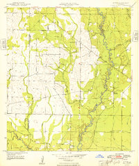
1947 Map of Pine Chapel
USGS Topo · Published 1947About this map
Calcasieu River winds through this section of Allen Parish, defining a landscape shaped by the early twentieth-century timber industry. The map illustrates a network of former timber routes, specifically the numerous sections of Old Logging Railroad Grade that crisscross the terrain north of the river. These grades, often following the drainages of Tenmile Creek and Mill Creek, reveal the intensive logging history of the region before it transitioned to the established transportation corridors shown here.
Find a feature on this map
15 named features on this map. Tap any name to fly to it.
Don’t see what you’re looking for? This feature index may not catch every label — zoom into the map to look around manually.
Map Details
Editions of this 1947 Pine Chapel Map
This is the sole edition of this map. No revisions or reprints were ever made.
Other maps of this area

1935 · Mittie
USGS Topo · 1:31,680

1935 · Oakdale
USGS Topo · 1:31,680

1942 · Oakdale
USGS Topo · 1:62,500

1947 · Foley
USGS Topo · 1:31,680

1947 · Oberlin
USGS Topo · 1:31,680

1947 · Le Blanc
USGS Topo · 1:31,680

1947 · Elizabeth
USGS Topo · 1:31,680

1947 · Grant
USGS Topo · 1:31,680

1948 · Grant
USGS Topo · 1:24,000
1948 · Mittie
USGS Topo · 1:24,000