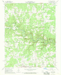
1968 Map of Pine Crest
USGS Topo · Published 1968About this map
Mountain View serves as a southern anchor for this section of the Ozarks during the late 1960s, where rural communities are defined by the deep dissection of the plateau. The map highlights the early preservation of the Ozark National Scenic Riverways, following the winding course of the North Prong Jacks Fork. Here, the landscape is a network of named hollows like Bell Hollow and Buck Hollow, which dictated the placement of small settlements and river crossings. Local genealogy and civic history are preserved in the locations of the Arroll School, Stallman School, and several rural burial grounds including Cold Spring Cemetery. The river itself features distinctive landmarks such as Chimney Rock Cave and river crossings like Harlow Ford and Ratcliff Ford, showing how transportation patterns remained tied to natural geography even as the region transitioned toward recreational land use.
Find a feature on this map
46 named features on this map. Tap any name to fly to it.
Don’t see what you’re looking for? This feature index may not catch every label — zoom into the map to look around manually.
Map Details
Editions of this 1968 Pine Crest Map
4 editions found
Other maps of this area

1945 · Willow Springs
USGS Topo · 1:62,500

1945 · Montier
USGS Topo · 1:62,500

1945 · Clear Springs
USGS Topo · 1:62,500

1946 · Summersville
USGS Topo · 1:62,500

1948 · Clear Springs
USGS Topo · 1:62,500

1948 · Montier
USGS Topo · 1:62,500

1948 · Willow Springs
USGS Topo · 1:62,500

1948 · Summersville
USGS Topo · 1:62,500

1949 · Rolla
USGS Topo · 1:250,000

1953 · Rolla
USGS Topo · 1:250,000