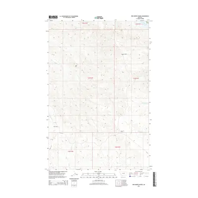
2014 Map of Pine Grove School
USGS Topo · Published 2014About this map
Pine Grove School stands as a lonely landmark in this high-plains landscape of Garfield County, where the terrain is defined by deep coulees and prominent ridgelines. The northern reaches of the survey are bounded by the Missouri River Fort Peck Lake, a massive water body that reshaped the region's geography. Moving south, the land rises into significant elevations such as Herman Ridge and the flat-topped summit of Table Top.
Find a feature on this map
20 named features on this map. Tap any name to fly to it.
Don’t see what you’re looking for? This feature index may not catch every label — zoom into the map to look around manually.
Map Details
Editions of this 2014 Pine Grove School Map
This is the sole edition of this map. No revisions or reprints were ever made.
Other maps of this area

1954 · Jordan
USGS Topo · 1:250,000

1956 · Jordan
USGS Topo · 1:250,000

1958 · Jordan
USGS Topo · 1:250,000

1964 · Jordan
USGS Topo · 1:250,000

1965 · Spring Creek School
USGS Topo · 1:24,000

1965 · Lost Creek
USGS Topo · 1:24,000

1965 · Herman Point
USGS Topo · 1:24,000

1965 · Cap Rock Butte
USGS Topo · 1:24,000

1965 · Pine Grove School
USGS Topo · 1:24,000

1965 · Schuyler Butte
USGS Topo · 1:24,000