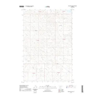
2020 Map of Pine Grove School
USGS Topo · Published 2020About this map
Pine Grove School stands as a focal point in this portion of Garfield County, situated where the high plains terrain meets the drainages feeding the Missouri River system. The landscape is defined by significant ridges and flat-topped mesas, most notably Herman Ridge and the distinctively named Table Top. These elevated features are dissected by numerous coulees and creeks, such as Hay Coulee and Devils Cr, which flow toward the northeastern corner where the waters of Fort Peck Lake become visible. This remote ranching landscape is connected by Brusett Rd, tracing the high ground between the various forks of N Sawmill Cr and S Sawmill Cr. The map's detailed topography reveals the complex network of intermittent streams and erosion patterns characteristic of the Big Dry country, providing a clear view of the area's geography as it appeared in 2020.
Find a feature on this map
18 named features on this map. Tap any name to fly to it.
Don’t see what you’re looking for? This feature index may not catch every label — zoom into the map to look around manually.
Map Details
Editions of this 2020 Pine Grove School Map
This is the sole edition of this map. No revisions or reprints were ever made.
Other maps of this area

1954 · Jordan
USGS Topo · 1:250,000

1956 · Jordan
USGS Topo · 1:250,000

1958 · Jordan
USGS Topo · 1:250,000

1964 · Jordan
USGS Topo · 1:250,000

1965 · Spring Creek School
USGS Topo · 1:24,000

1965 · Lost Creek
USGS Topo · 1:24,000

1965 · Herman Point
USGS Topo · 1:24,000

1965 · Cap Rock Butte
USGS Topo · 1:24,000

1965 · Pine Grove School
USGS Topo · 1:24,000

1965 · Schuyler Butte
USGS Topo · 1:24,000