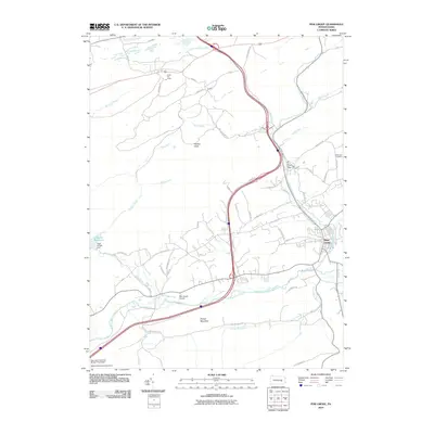
2010 Map of Pine Grove
USGS Topo · Published 2010About this map
Pine Grove serves as the primary settlement hub in this 2010 survey, situated at the confluence of several vital waterways including Swatara Creek and Mill Creek. The landscape is defined by the sharp rise of Swope Mountain and Panther Head, while the southern reaches are traversed by the legendary Appalachian Trl. This area reflects a complex water management and industrial legacy, evidenced by features such as the High Bridge Dam at Lebanon Reservoir and the New Saint Nicholas Breaker Pond Dam. Local history is anchored by the Hollernan Cemetery and the village of Dorans, with the Keffer Fire Tower standing as a sentinel over the surrounding ridges. The map also documents the Pine Grove Airport and a dense network of mountain roads like Goldmine Rd and Swopes Valley Rd, illustrating the modern connectivity of this Pennsylvania corridor.
Find a feature on this map
56 named features on this map. Tap any name to fly to it.
Don’t see what you’re looking for? This feature index may not catch every label — zoom into the map to look around manually.
Map Details
Editions of this 2010 Pine Grove Map
This is the sole edition of this map. No revisions or reprints were ever made.
Other maps of this area

1891 · Lebanon
USGS Topo · 1:62,500

1892 · Lykens
USGS Topo · 1:62,500

1892 · Hummelstown
USGS Topo · 1:62,500

1892 · Pine Grove
USGS Topo · 1:62,500

1893 · Lykens
USGS Topo · 1:62,500

1893 · Lebanon
USGS Topo · 1:62,500

1899 · Lebanon
USGS Topo · 1:62,500

1924 · Hummelstown
USGS Topo · 1:62,500

1943 · Lebanon
USGS Topo · 1:62,500

1943 · Lykens
USGS Topo · 1:62,500
Featured Places
- Bethel Township, PA
- Hegins Township, PA
- Pine Grove, Pine Grove Township
- Frailey Township, PA
- Brookside, Pine Grove Township