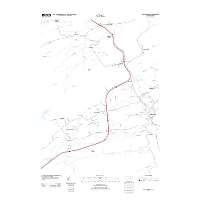
2013 Map of Pine Grove
USGS Topo · Published 2013About this map
Pine Grove serves as the primary hub in this landscape, situated along the Swatara Cr where several local roads and rural paths converge. The map illustrates a complex network of small settlements and named junctions, reflecting the industrial and agricultural heritage of Berks and Schuylkill counties. Notable landmarks like the Keffer Fire Tower near Keffers and the Fairview Farm Airfield north of Suedberg indicate the mix of forestry management and local aviation. The terrain is defined by prominent elevations such as Swope Mountain and Panther Head, which overlook a series of creeks and runs including Lorberry Cr and DeHaas Run. Smaller communities such as Lorberry Junction, Joliett, and Brookside are scattered throughout, connected by a dense weave of named township highways and trails like Goldmine Rd.
Find a feature on this map
125 named features on this map. Tap any name to fly to it.
Don’t see what you’re looking for? This feature index may not catch every label — zoom into the map to look around manually.
Map Details
Editions of this 2013 Pine Grove Map
This is the sole edition of this map. No revisions or reprints were ever made.
Other maps of this area

1891 · Lebanon
USGS Topo · 1:62,500

1892 · Lykens
USGS Topo · 1:62,500

1892 · Hummelstown
USGS Topo · 1:62,500

1892 · Pine Grove
USGS Topo · 1:62,500

1893 · Lykens
USGS Topo · 1:62,500

1893 · Lebanon
USGS Topo · 1:62,500

1899 · Lebanon
USGS Topo · 1:62,500

1924 · Hummelstown
USGS Topo · 1:62,500

1943 · Lebanon
USGS Topo · 1:62,500

1943 · Lykens
USGS Topo · 1:62,500
Featured Places
- Bethel Township, PA
- Hegins Township, PA
- Pine Grove, Pine Grove Township
- Frailey Township, PA
- Brookside, Pine Grove Township