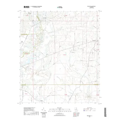
2020 Map of Pine Grove
USGS Topo · Published 2020About this map
Grangeville and Pine Grove serve as the primary nodes of settlement in this part of St. Helena Parish, where the winding course of the Amite River defines the western terrain. The landscape is deeply etched by a network of tributaries, including Pigeon Cr, W Hog Br, and Beaver Dam Cr, which feed into the larger river systems. A clear pattern of rural life is evident through the numerous family-named landmarks and burial grounds scattered across the townships, such as Claiborne Cem, Harrell Cem, and Mullens Cem. Local transportation relies on a web of named rural routes like Greenwell Springs Rd and St Joseph Rd, which connect these small communities to the surrounding timberlands and agricultural plots. The presence of the Overton Private Airport near the western boundary adds a modern navigational marker to this otherwise traditional Louisiana landscape.
Find a feature on this map
73 named features on this map. Tap any name to fly to it.
Don’t see what you’re looking for? This feature index may not catch every label — zoom into the map to look around manually.
Map Details
Editions of this 2020 Pine Grove Map
This is the sole edition of this map. No revisions or reprints were ever made.
Other maps of this area

1941 · Gilead
USGS Topo · 1:31,680

1942 · Montpelier
USGS Topo · 1:31,680

1942 · Pine Grove
USGS Topo · 1:31,680

1942 · Pride
USGS Topo · 1:31,680

1942 · Gilead
USGS Topo · 1:31,680

1942 · Watson
USGS Topo · 1:31,680

1942 · Satsuma
USGS Topo · 1:31,680

1949 · Bluff Creek
USGS Topo · 1:31,680

1950 · Doyle
USGS Topo · 1:31,680

1950 · Greensburg
USGS Topo · 1:31,680