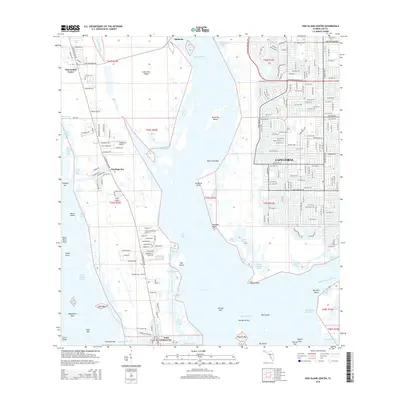
2015 Map of Pine Island Center
USGS Topo · Published 2015About this map
Pine Island Center and the surrounding island communities anchor this coastal survey, showing the complex boundary between developed Lee County residential zones and the intricate subtropical wetlands. To the east, the sprawling canal-based layout of Cape Coral pushes against the Matlacha Pass, while the unincorporated community of Matlacha serves as the gateway to the main island. The landscape is defined by its aquatic connectivity, featuring the Okeechobee Waterway and the Phillips Canal cutting through the southern mangroves near Saint James City.
Find a feature on this map
121 named features on this map. Tap any name to fly to it.
Don’t see what you’re looking for? This feature index may not catch every label — zoom into the map to look around manually.
Map Details
Editions of this 2015 Pine Island Center Map
This is the sole edition of this map. No revisions or reprints were ever made.
Other maps of this area

1956 · West Palm Beach
USGS Topo · 1:250,000

1956 · Tampa
USGS Topo · 1:250,000

1956 · Charlotte Harbor
USGS Topo · 1:250,000

1957 · West Palm Beach
USGS Topo · 1:250,000

1958 · West Palm Beach
USGS Topo · 1:250,000

1958 · Matlacha
USGS Topo · 1:24,000

1958 · Captiva
USGS Topo · 1:24,000

1958 · Fort Myers NW
USGS Topo · 1:24,000

1958 · Fort Myers SW
USGS Topo · 1:24,000

1958 · Sanibel
USGS Topo · 1:24,000