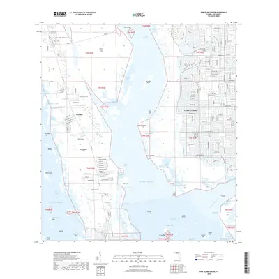
2018 Map of Pine Island Center
USGS Topo · Published 2018About this map
Pine Island and the western suburban edge of Cape Coral anchor this 2018 survey of the Lee County coast. The map illustrates the contrast between the dense, canal-lined residential grids of the mainland and the more dispersed settlements of Pine Island Center, Flamingo Bay, and St. James City. This island chain is separated from the mainland by the shallow waters of Matlacha Pass, while the southern tip of the map reaches toward Punta Rassa and the mouth of the Caloosahatchee River. Local aviation history is marked by the presence of Woodstock Airport on the northern portion of the island. Significant water features including the Intracoastal Waterway and the Okeechobee Waterway intersect here, highlighting the region's importance for maritime navigation. Terrain details identify numerous small keys and bays such as Deer Stop Keys and Forty Acre Bay, providing a clear look at the intricate coastline before modern environmental changes.
Find a feature on this map
163 named features on this map. Tap any name to fly to it.
Don’t see what you’re looking for? This feature index may not catch every label — zoom into the map to look around manually.
Map Details
Editions of this 2018 Pine Island Center Map
This is the sole edition of this map. No revisions or reprints were ever made.
Other maps of this area

1956 · West Palm Beach
USGS Topo · 1:250,000

1956 · Tampa
USGS Topo · 1:250,000

1956 · Charlotte Harbor
USGS Topo · 1:250,000

1957 · West Palm Beach
USGS Topo · 1:250,000

1958 · West Palm Beach
USGS Topo · 1:250,000

1958 · Matlacha
USGS Topo · 1:24,000

1958 · Captiva
USGS Topo · 1:24,000

1958 · Fort Myers NW
USGS Topo · 1:24,000

1958 · Fort Myers SW
USGS Topo · 1:24,000

1958 · Sanibel
USGS Topo · 1:24,000