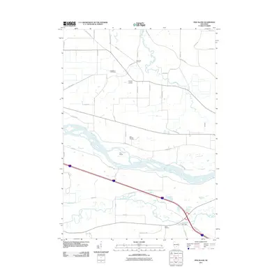
2011 Map of Pine Island
USGS Topo · Published 2011About this map
The Wisconsin River meanders through this portion of Columbia County, creating a complex network of channels and backwaters around Pine Island. This landscape is defined by its riparian geometry, where the Baraboo River and Leech Creek converge near the settlement of Fox Glen. The area's agricultural and social history is etched into the grid of country roads, marked by several local burial grounds including the Welsh Cemetery and Saint Paul Lutheran Cemetery. Water management is a visible priority on the land, evidenced by the Lewiston 2 C 6118 Dam and the long stretches of Levee Rd that parallel the riverbanks. This 2011 survey serves as a detailed record of the rural infrastructure and natural drainage patterns, from the northern reach of Big Slough down to the southern intersections near the Baraboo River.
Find a feature on this map
47 named features on this map. Tap any name to fly to it.
Don’t see what you’re looking for? This feature index may not catch every label — zoom into the map to look around manually.
Map Details
Editions of this 2011 Pine Island Map
This is the sole edition of this map. No revisions or reprints were ever made.
Other maps of this area

1895 · Baraboo
USGS Topo · 1:62,500

1901 · Poynette
USGS Topo · 1:62,500

1902 · Portage
USGS Topo · 1:62,500

1902 · Briggsville
USGS Topo · 1:62,500

1908 · Baraboo
USGS Topo · 1:62,500

1957 · Madison
USGS Topo · 1:250,000

1958 · Briggsville
USGS Topo · 1:62,500

1959 · Baraboo
USGS Topo · 1:62,500

1960 · Madison
USGS Topo · 1:250,000

1962 · Poynette
USGS Topo · 1:62,500