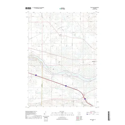
2018 Map of Pine Island
USGS Topo · Published 2018About this map
Wisconsin River and Baraboo River converge in this section of Columbia County, creating a complex landscape of wetlands and waterways. The namesake Pine Island sits within the shifting channels of the river, while the elevation rises sharply to the south at North Range and Cascade Mtn. This area is defined by its rural heritage, marked by several historic religious sites including Saint Paul Lutheran Cem, Saint Michaels Cem, and Welsh Church Cem. A dense network of agricultural roads like Cheese Factory Rd and Adney Rd reveals the longstanding dairy and farming traditions of the region. The map also traces the winding course of the Big Slough and Leech Creek, documenting the hydraulic character of the terrain just west of Portage.
Find a feature on this map
56 named features on this map. Tap any name to fly to it.
Don’t see what you’re looking for? This feature index may not catch every label — zoom into the map to look around manually.
Map Details
Editions of this 2018 Pine Island Map
This is the sole edition of this map. No revisions or reprints were ever made.
Other maps of this area

1895 · Baraboo
USGS Topo · 1:62,500

1901 · Poynette
USGS Topo · 1:62,500

1902 · Portage
USGS Topo · 1:62,500

1902 · Briggsville
USGS Topo · 1:62,500

1908 · Baraboo
USGS Topo · 1:62,500

1957 · Madison
USGS Topo · 1:250,000

1958 · Briggsville
USGS Topo · 1:62,500

1959 · Baraboo
USGS Topo · 1:62,500

1960 · Madison
USGS Topo · 1:250,000

1962 · Poynette
USGS Topo · 1:62,500