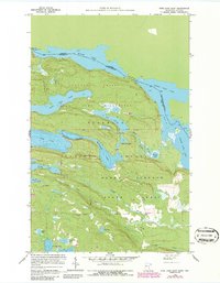
1959 Map of Pine Lake East
USGS Topo · Published 1986About this map
Moose Lake and the international boundary between Ontario and Minnesota define the upper reaches of this northern landscape. This 1959 survey, updated in the mid-1980s, highlights the intricate hydrologic network of the Boundary Waters Canoe Area Wilderness, where the Royal River connects John Lake to the border waters. The map provides a detailed look at the transition between the Superior National Forest and the Grand Portage State Forest. Traditional transit routes like the Great Cherry Portage and Moose Portage illustrate the historic movement patterns through this lake-heavy terrain. Southward, the topography drops toward McFarland Lake and Pine Lake, showing the primitive road access and depth curves for several interior lakes such as Devilfish Lake and Stump Lake.
Find a feature on this map
31 named features on this map. Tap any name to fly to it.
Don’t see what you’re looking for? This feature index may not catch every label — zoom into the map to look around manually.
Map Details
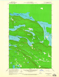
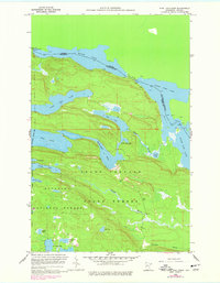
Editions of this 1959 Pine Lake East Map
4 editions found
Other maps of this area

1954 · Two Harbors
USGS Topo · 1:250,000

1957 · Two Harbors
USGS Topo · 1:250,000

1957 · Quetico
USGS Topo · 1:250,000

1958 · Two Harbors
USGS Topo · 1:250,000

1958 · Hancock
USGS Topo · 1:250,000

1959 · Northern Light Lake
USGS Topo · 1:24,000

1959 · Pine Lake East
USGS Topo · 1:24,000

1959 · Tom Lake
USGS Topo · 1:24,000

1959 · Pine Lake West
USGS Topo · 1:24,000

1959 · Fort William
USGS Topo · 1:250,000