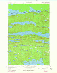
1959 Map of Pine Lake West
USGS Topo · Published 1978About this map
The Canada United States border cuts through the northern reaches of this wilderness landscape, following the waters of Fan Lake, Vaseux Lake, and Pemmican Lake. Situated within the Superior National Forest, the terrain is defined by a dense network of lakes and ridges, notably the prominent Moose Mountain which stands north of Canuck Lake. This 1950s survey captures the primitive transportation routes used to navigate the international boundary, including the Great Cherry Portage and Lesser Cherry Portage near the Thunder Bay District and Cook County line. Long, linear water bodies like West Pike Lake and Pine Lake dominate the central geography, separated by narrow ridges. To the south, smaller catchments such as Spaulding Lake, Crystal Lake, and Pierz Lake fill the basins between high ground, illustrating the complex drainage patterns of the Minnesota arrowhead region before modern recreational development.
Find a feature on this map
46 named features on this map. Tap any name to fly to it.
Don’t see what you’re looking for? This feature index may not catch every label — zoom into the map to look around manually.
Map Details
Editions of this 1959 Pine Lake West Map
4 editions found
Other maps of this area

1954 · Two Harbors
USGS Topo · 1:250,000

1957 · Two Harbors
USGS Topo · 1:250,000

1957 · Quetico
USGS Topo · 1:250,000

1958 · Two Harbors
USGS Topo · 1:250,000

1959 · Northern Light Lake
USGS Topo · 1:24,000

1959 · Pine Mountain
USGS Topo · 1:24,000

1959 · Pine Lake East
USGS Topo · 1:24,000

1959 · Tom Lake
USGS Topo · 1:24,000

1959 · Pine Lake West
USGS Topo · 1:24,000

1959 · Crocodile Lake
USGS Topo · 1:24,000