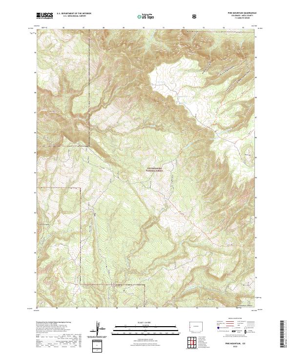
2022 Map of Pine Mountain
USGS Topo · Published 2022About this map
The Uncompahgre National Forest dominates this section of the Uncompahgre Plateau, characterized by its deep canyons and prominent mesas. Unaweep Canyon and Yellowjacket Canyon cut through the northern terrain, while Tenderfoot Mesa rises above the dramatic descent into Maverick Canyon to the west. This landscape is defined by an intricate network of backcountry trails and forest roads, including the Ute Creek Trl and Cow Creek Trl, which provide access to isolated water features such as Rim Pond, Far Pond, and Big Pond. The topography reflects the high-altitude environment of Mesa County, where drainages like Calamity Cr and Cow Cr have carved significant features into the plateau. The map details various forest service routes such as 11 3/10 Rd, tracing the movement of land management and recreation through this protected wilderness.
Find a feature on this map
44 named features on this map. Tap any name to fly to it.
Don’t see what you’re looking for? This feature index may not catch every label — zoom into the map to look around manually.
Map Details
Editions of this 2022 Pine Mountain Map
This is the sole edition of this map. No revisions or reprints were ever made.
Other maps of this area

1949 · Juanita Arch
USGS Topo · 1:24,000

1949 · Calamity Mesa
USGS Topo · 1:24,000

1949 · Gateway
USGS Topo · 1:24,000

1950 · Juanita Arch
USGS Topo · 1:24,000

1950 · Calamity Mesa
USGS Topo · 1:24,000

1950 · Pine Mountain
USGS Topo · 1:24,000

1952 · Gateway
USGS Topo · 1:24,000

1956 · Moab
USGS Topo · 1:250,000

1959 · Moab
USGS Topo · 1:250,000

1960 · Moab
USGS Topo · 1:250,000