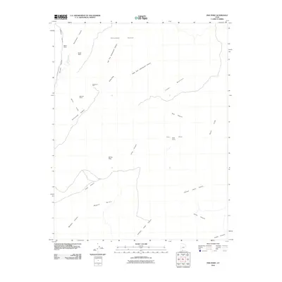
2010 Map of Pine Point
USGS Topo · Published 2010About this map
The Montezuma Mine sits isolated within a landscape dominated by the striking geologic formations of the White Cliffs and the elevated plateaus of Skutumpah Terrace. This 2010 survey records a high-desert environment defined by dramatic vertical relief, where cattle ranching and mineral exploration have historically shaped the human presence. Significant drainages like Johnson Canyon and Long Canyon cut through the terrain, providing natural corridors through the varied topography of Wygaret Terrace and Timber Mountain. The presence of Billy Pasture and several named points, including Second Point and Spring Point, indicates a legacy of local land use and geographic navigation in this part of Kane County. Transportation is limited to the periphery, notably via N Johnson Canyon Rd, reflecting the area's enduring character as an expansive wilderness area.
Find a feature on this map
23 named features on this map. Tap any name to fly to it.
Don’t see what you’re looking for? This feature index may not catch every label — zoom into the map to look around manually.
Map Details
Editions of this 2010 Pine Point Map
This is the sole edition of this map. No revisions or reprints were ever made.
Other maps of this area

1886 · Kanab
USGS Topo · 1:250,000

1953 · Cedar City
USGS Topo · 1:250,000

1954 · Buckskin Gulch NW
USGS Topo · 1:24,000

1954 · Buckskin Gulch SW
USGS Topo · 1:24,000

1954 · Johnson SE
USGS Topo · 1:24,000

1954 · Johnson NE
USGS Topo · 1:24,000

1954 · Johnson SW
USGS Topo · 1:24,000

1954 · Buckskin Gulch
USGS Topo · 1:62,500

1954 · Johnson
USGS Topo · 1:62,500

1958 · Cedar City
USGS Topo · 1:250,000