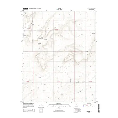
2014 Map of Pine Point
USGS Topo · Published 2014About this map
White Cliffs and Wygaret Terrace define the dramatic high-desert topography of this Kane County region. The map centers on a complex system of drainages and named canyon floors, including the deep Johnson Canyon and its many branches like Skutumpah Canyon and Left Fork Cottonwood Canyon. This 2014 survey documents the network of primitive roads and tracks that provide access to the interior, such as Nephi Pasture Rd and the Pink Cove Loop, which navigate around prominent landmarks like Timber Mtn and Nephi Point. The landscape is largely defined by these erosion-formed features and seasonal water sources like Neaf Spring, showing a part of the American West where geography dictates movement and land use long after the era of initial settlement.
Find a feature on this map
30 named features on this map. Tap any name to fly to it.
Don’t see what you’re looking for? This feature index may not catch every label — zoom into the map to look around manually.
Map Details
Editions of this 2014 Pine Point Map
This is the sole edition of this map. No revisions or reprints were ever made.
Other maps of this area

1886 · Kanab
USGS Topo · 1:250,000

1953 · Cedar City
USGS Topo · 1:250,000

1954 · Buckskin Gulch NW
USGS Topo · 1:24,000

1954 · Buckskin Gulch SW
USGS Topo · 1:24,000

1954 · Johnson SE
USGS Topo · 1:24,000

1954 · Johnson NE
USGS Topo · 1:24,000

1954 · Johnson SW
USGS Topo · 1:24,000

1954 · Buckskin Gulch
USGS Topo · 1:62,500

1954 · Johnson
USGS Topo · 1:62,500

1958 · Cedar City
USGS Topo · 1:250,000