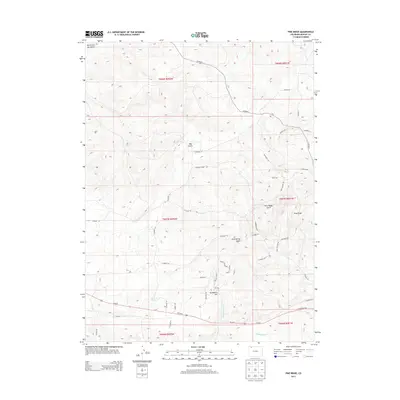
2013 Map of Pine Ridge
USGS Topo · Published 2013About this map
Pine Ridge rises as a prominent geographic feature within the high desert landscape of Moffat County, northwest of Craig. This 2013 survey reveals a transition from the drainage basins of Big Gulch and North Fork Big Gulch in the north toward the more developed corridor near Severnmile Hill and the southern highway routes. The map documents a dense network of county roads and residential developments, such as those along Valley View DR and Crown DR, indicating the area's expansion. Essential water sources for the region, including Sand Spring and its namesake Sand Spring Gulch, are clearly delineated alongside modern infrastructure like Us-40 W. The topographical detail captures the complex drainage systems and ridges that have historically influenced settlement patterns in this part of the Colorado plateau.
Find a feature on this map
41 named features on this map. Tap any name to fly to it.
Don’t see what you’re looking for? This feature index may not catch every label — zoom into the map to look around manually.
Map Details
Editions of this 2013 Pine Ridge Map
This is the sole edition of this map. No revisions or reprints were ever made.
Other maps of this area

1910 · Danforth Hills
USGS Topo · 1:125,000

1912 · Axial
USGS Topo · 1:62,500

1914 · Axial
USGS Topo · 1:62,500

1915 · Monument Butte
USGS Topo · 1:62,500

1916 · Craig
USGS Topo · 1:125,000

1954 · Craig
USGS Topo · 1:250,000

1957 · Craig
USGS Topo · 1:250,000

1958 · Craig
USGS Topo · 1:250,000

1960 · Craig
USGS Topo · 1:250,000

1962 · Craig
USGS Topo · 1:250,000