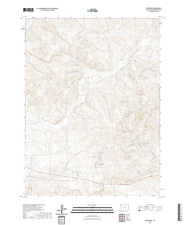
2022 Map of Pine Ridge
USGS Topo · Published 2022About this map
Sevenmile Hill rises above a high-desert landscape defined by complex drainage networks and the prominent landform of Pine Ridge. The geography of this corner of Moffat County is marked by seasonal watercourses like Big Gulch and the North Fork Big Gulch, which have carved deep into the terrain. Local landmarks such as Sand Spring provide rare water sources in a region dominated by sagebrush and scrub. The road system is a mix of utilitarian county routes and more descriptive paths like Ponderosa Pass and Pine Ridge Trl, which follow the contours of the high ground. Further south, the map reveals a pocket of residential development with named streets like Valley View DR and Crown DR near the foot of the hill, indicating the gradual encroachment of modern infrastructure into this traditionally ranch-and-range territory.
Find a feature on this map
41 named features on this map. Tap any name to fly to it.
Don’t see what you’re looking for? This feature index may not catch every label — zoom into the map to look around manually.
Map Details
Editions of this 2022 Pine Ridge Map
This is the sole edition of this map. No revisions or reprints were ever made.
Other maps of this area

1910 · Danforth Hills
USGS Topo · 1:125,000

1912 · Axial
USGS Topo · 1:62,500

1914 · Axial
USGS Topo · 1:62,500

1915 · Monument Butte
USGS Topo · 1:62,500

1916 · Craig
USGS Topo · 1:125,000

1954 · Craig
USGS Topo · 1:250,000

1957 · Craig
USGS Topo · 1:250,000

1958 · Craig
USGS Topo · 1:250,000

1960 · Craig
USGS Topo · 1:250,000

1962 · Craig
USGS Topo · 1:250,000