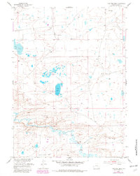
1955 Map of Pine Tree Ridge
USGS Topo · Published 1982About this map
Pine Tree Ridge stands as the dominant landform in this high-plains landscape of Albany County, where the hydrology is defined by a network of alkaline basins and ephemeral drainages. The central portion of the sheet is characterized by the S O D A L A K E S, including the prominent Soda Lake, which likely reflects the mineral-rich geology of the region. This saline environment is contrasted by the flow of Rock Creek and Sevenmile Creek to the south, providing a rare source of surface water in an otherwise arid expanse. Industrial activity is evident through the presence of a Bentonite Mine (Inactive) and a Gravel Pit, signaling the area's history of mineral extraction. For the genealogist or local historian, the map preserves the location of a lone Cem and the path of an Old Railroad Grade, marking the physical remains of early transportation and settlement patterns that once crossed this territory.
Find a feature on this map
13 named features on this map. Tap any name to fly to it.
Don’t see what you’re looking for? This feature index may not catch every label — zoom into the map to look around manually.
Map Details
Editions of this 1955 Pine Tree Ridge Map
2 editions found
Other maps of this area

1915 · Como Ridge
USGS Topo · 1:48,000

1918 · Como Ridge
USGS Topo · 1:62,500

1954 · Torrington
USGS Topo · 1:250,000

1954 · Cheyenne
USGS Topo · 1:250,000

1954 · Rawlins
USGS Topo · 1:250,000

1955 · Pine Tree Ridge
USGS Topo · 1:24,000

1955 · Sevenmile Spring
USGS Topo · 1:24,000

1955 · Cannonball Cut
USGS Topo · 1:24,000

1955 · Wilcox
USGS Topo · 1:24,000

1955 · Casper
USGS Topo · 1:250,000