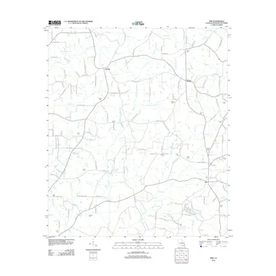
2012 Map of Pine
USGS Topo · Published 2012About this map
Hackley, Thomas, and Pine anchor this rural landscape in Washington Parish, where family-named cemeteries and winding creek branches define the local geography. The area is heavily intersected by small watercourses such as Brown Br, Boggy Br, and Thomas Br, which drain toward the larger Lawrence Cr system. For genealogists and local historians, the high density of family burial grounds is particularly significant, including Magee Cem, Schilling Cem, Breland Cem, and Knight Cem. The road network often bears the names of established families, with routes like Purvis Thomas Rd and Othaney Simmons Rd connecting these dispersed rural settlements. This 2012 survey captures the persistent rural character of northeastern Louisiana, showing a landscape still primarily organized around agricultural life and ancestral homesteads.
Find a feature on this map
138 named features on this map. Tap any name to fly to it.
Don’t see what you’re looking for? This feature index may not catch every label — zoom into the map to look around manually.
Map Details
Editions of this 2012 Pine Map
This is the sole edition of this map. No revisions or reprints were ever made.
Other maps of this area

1939 · Clifton
USGS Topo · 1:31,680

1942 · Thigpen
USGS Topo · 1:31,680

1942 · Thomas
USGS Topo · 1:31,680

1949 · Bogalusa West
USGS Topo · 1:31,680

1950 · Crains Creek
USGS Topo · 1:31,680

1950 · Franklinton
USGS Topo · 1:31,680

1953 · Hattiesburg
USGS Topo · 1:250,000

1953 · Natchez
USGS Topo · 1:250,000

1953 · Mobile
USGS Topo · 1:250,000

1954 · Baton Rouge
USGS Topo · 1:250,000