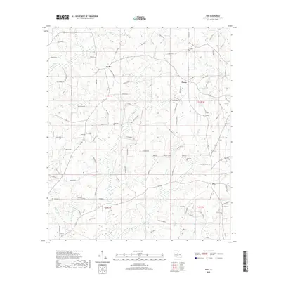
2020 Map of Pine
USGS Topo · Published 2020About this map
The community of Hackley and the rural surroundings of Washington Parish are defined by a complex network of waterways, where Hays Cr and Indian Cr drain the northern landscape. This 2020 survey illustrates a region with deeply rooted family history, evidenced by numerous small burial grounds such as Magee Cem and Schilling Cem scattered across the land. The settlement pattern follows a series of parish roads that connect the smaller hubs of Thomas and Pine. Significant drainage basins, including the W Fork Lawrence Cr and E Fork Lawrence Cr, carve through the terrain, influencing the placement of homesteads and local infrastructure. For genealogists, the map is a critical reference for locating remote family sites like Payne Cem or Fisher Cem which remain preserved within the modern property boundaries of these Louisiana townships.
Find a feature on this map
125 named features on this map. Tap any name to fly to it.
Don’t see what you’re looking for? This feature index may not catch every label — zoom into the map to look around manually.
Map Details
Editions of this 2020 Pine Map
This is the sole edition of this map. No revisions or reprints were ever made.
Other maps of this area

1939 · Clifton
USGS Topo · 1:31,680

1942 · Thigpen
USGS Topo · 1:31,680

1942 · Thomas
USGS Topo · 1:31,680

1949 · Bogalusa West
USGS Topo · 1:31,680

1950 · Crains Creek
USGS Topo · 1:31,680

1950 · Franklinton
USGS Topo · 1:31,680

1953 · Hattiesburg
USGS Topo · 1:250,000

1953 · Natchez
USGS Topo · 1:250,000

1953 · Mobile
USGS Topo · 1:250,000

1954 · Baton Rouge
USGS Topo · 1:250,000