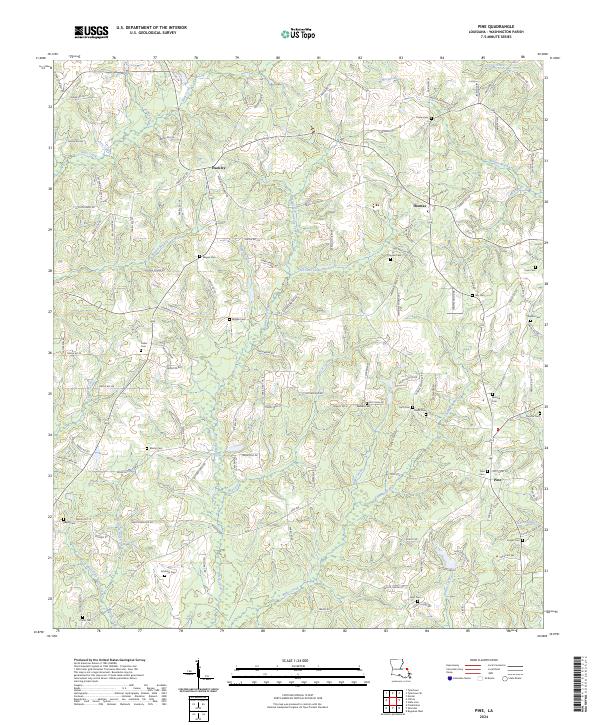
2024 Map of Pine
USGS Topo · Published 2024About this map
Hackley, Thomas, and Pine anchor this section of Washington Parish, where the landscape is defined by the dendritic drainage of Lawrence Creek and its many tributaries. The area is notable for its high density of family-named burial grounds, such as Schilling Cem, Magee Cem, and Payne Cem, which offer significant value for genealogists and local historians tracing the settlement patterns of north-central Louisiana.
Find a feature on this map
130 named features on this map. Tap any name to fly to it.
Don’t see what you’re looking for? This feature index may not catch every label — zoom into the map to look around manually.
Map Details
Editions of this 2024 Pine Map
This is the sole edition of this map. No revisions or reprints were ever made.
Other maps of this area

1939 · Clifton
USGS Topo · 1:31,680

1942 · Thigpen
USGS Topo · 1:31,680

1942 · Thomas
USGS Topo · 1:31,680

1949 · Bogalusa West
USGS Topo · 1:31,680

1950 · Crains Creek
USGS Topo · 1:31,680

1950 · Franklinton
USGS Topo · 1:31,680

1953 · Hattiesburg
USGS Topo · 1:250,000

1953 · Natchez
USGS Topo · 1:250,000

1953 · Mobile
USGS Topo · 1:250,000

1954 · Baton Rouge
USGS Topo · 1:250,000