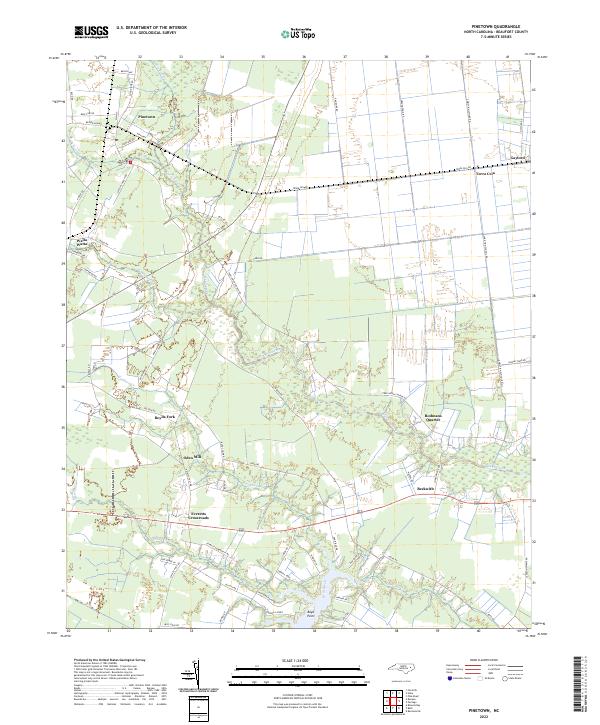
2022 Map of Pinetown
USGS Topo · Published 2022About this map
Pinetown anchors this landscape in eastern Beaufort County, where a network of low-lying wetlands and agricultural tracts defines the regional character. The terrain is crisscrossed by several significant watercourses, including Acre Swamp, Pungo Swamp, and the upper reaches of Bath Creek. This 2022 survey details a series of rural crossroads and historic community centers like Everetts Crossroads, Oden Mill, and Rodmans Quarter.
Find a feature on this map
68 named features on this map. Tap any name to fly to it.
Don’t see what you’re looking for? This feature index may not catch every label — zoom into the map to look around manually.
Map Details
Editions of this 2022 Pinetown Map
This is the sole edition of this map. No revisions or reprints were ever made.
Other maps of this area

1914 · Belhaven
USGS Topo · 1:48,000

1916 · Belhaven
USGS Topo · 1:62,500

1943 · Plymouth
USGS Topo · 1:125,000

1950 · Pinetown
USGS Topo · 1:24,000

1951 · Bunyan
USGS Topo · 1:24,000

1951 · Bath
USGS Topo · 1:24,000

1951 · Ransomville
USGS Topo · 1:24,000

1951 · Pantego
USGS Topo · 1:24,000

1953 · Blounts Bay
USGS Topo · 1:24,000

1953 · Rocky Mount
USGS Topo · 1:250,000