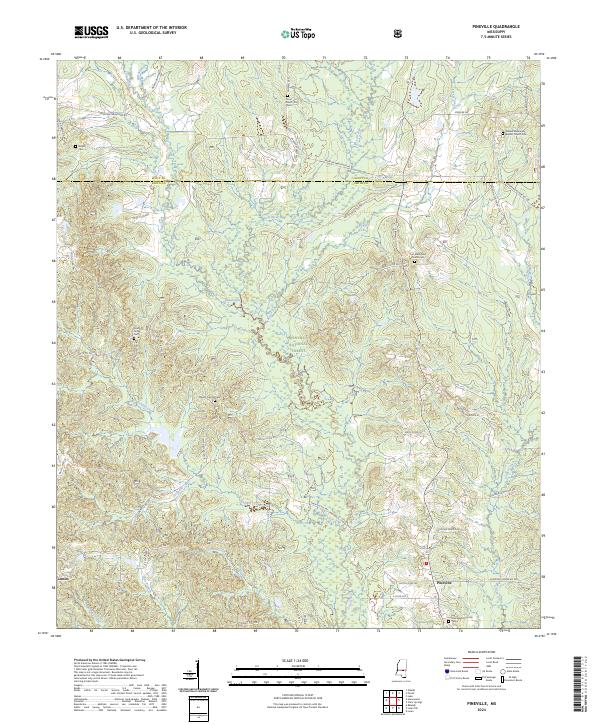
2024 Map of Pineville
USGS Topo · Published 2024About this map
The Leaf River and its dense network of tributaries, including Tishkill Creek, Redhead Creek, and Tallabogue, carve through the heart of the Bienville National Forest in this central Mississippi landscape. This area, spanning the border of Scott and Smith counties, is characterized by small rural settlements and numerous family-named landmarks. The map records several vital genealogical sites, such as the Crout Sisters Cem and the Noblin Cem, alongside community centers like the Leaf River Baptist Church Cem.
Find a feature on this map
64 named features on this map. Tap any name to fly to it.
Don’t see what you’re looking for? This feature index may not catch every label — zoom into the map to look around manually.
Map Details
Editions of this 2024 Pineville Map
This is the sole edition of this map. No revisions or reprints were ever made.
Other maps of this area

1921 · Forest
USGS Topo · 1:48,000

1922 · Forest
USGS Topo · 1:62,500

1922 · Morton
USGS Topo · 1:48,000

1924 · Morton
USGS Topo · 1:62,500

1950 · Forest
USGS Topo · 1:62,500

1951 · Morton
USGS Topo · 1:62,500

1952 · Forest
USGS Topo · 1:62,500

1953 · Meridian
USGS Topo · 1:250,000

1957 · Meridian
USGS Topo · 1:250,000

1965 · Meridian
USGS Topo · 1:250,000