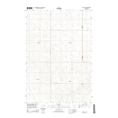
2014 Map of Piney Butte
USGS Topo · Published 2014About this map
Piney Butte rises above the southeastern Montana prairie on this 2014 survey of the borderlands between Fallon and Carter counties. The landscape is defined by its drainage network, with Spring Cr and the S Fork Milk Cr cutting through the high plains. A sparse grid of rural routes, including Plevna Rd and Valley Rd, follows the section lines of the Public Land Survey System, which divides the territory into Townships t4n r57e and t3n r58e. To the south, the terrain descends toward the E Fork O'Fallon Cr and the headwaters of Collins Cr. This modern topographic study reflects a sparsely populated ranching landscape where the original township grids remain the primary framework for navigation and land management.
Find a feature on this map
14 named features on this map. Tap any name to fly to it.
Don’t see what you’re looking for? This feature index may not catch every label — zoom into the map to look around manually.
Map Details
Editions of this 2014 Piney Butte Map
This is the sole edition of this map. No revisions or reprints were ever made.
Other maps of this area

1953 · Miles City
USGS Topo · 1:250,000

1954 · Ekalaka
USGS Topo · 1:250,000

1956 · Ekalaka
USGS Topo · 1:250,000

1957 · Miles City
USGS Topo · 1:250,000

1958 · Miles City
USGS Topo · 1:250,000

1958 · Ekalaka
USGS Topo · 1:250,000

1965 · Ekalaka
USGS Topo · 1:250,000

1979 · Ekalaka
USGS Topo · 1:24,000

1979 · Beaver Flats North
USGS Topo · 1:24,000
1980 · Terrell Creek
USGS Topo · 1:24,000