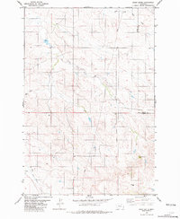
1981 Map of Piney Butte
USGS Topo · Published 1981About this map
Piney Butte stands as a prominent landmark in this eastern Montana landscape, situated near the shifting boundaries of Carter and Fallon counties. The area is defined by its vital water sources in an arid region, with the drainage of South Fork Milk Creek in the north and the East Fork O'Fallon Creek to the south. Small tributaries like Spring Creek wind through the terrain, punctuated by isolated infrastructure such as Flowing Well and various unnamed wells and springs. The mapping reflects a period in the early 1980s when the region remained dominated by large-scale ranching and open rangeland, where named natural features and reliable water points served as the primary coordinates for local navigation and land management.
Find a feature on this map
9 named features on this map. Tap any name to fly to it.
Don’t see what you’re looking for? This feature index may not catch every label — zoom into the map to look around manually.
Map Details
Editions of this 1981 Piney Butte Map
This is the sole edition of this map. No revisions or reprints were ever made.
Other maps of this area

1953 · Miles City
USGS Topo · 1:250,000

1954 · Ekalaka
USGS Topo · 1:250,000

1956 · Ekalaka
USGS Topo · 1:250,000

1957 · Miles City
USGS Topo · 1:250,000

1958 · Miles City
USGS Topo · 1:250,000

1958 · Ekalaka
USGS Topo · 1:250,000

1965 · Ekalaka
USGS Topo · 1:250,000

1979 · Ekalaka
USGS Topo · 1:24,000

1979 · Beaver Flats North
USGS Topo · 1:24,000
1980 · Terrell Creek
USGS Topo · 1:24,000