
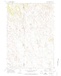
1971 Map of Piney Canyon NE
USGS Topo · Published 1974About this map
Black Thunder Creek and Little Thunder Creek carve through the high plains at the border of Campbell and Weston Counties. This early 1970s landscape is characterized by its wide-ranging water systems and sparse human habitation, anchored by the Small Ranch settlement along Little Thunder Road. Evidence of industrial exploration is present throughout the quadrangle, with scattered Oil Wells and numerous Drill Holes indicating the era’s intensive energy surveying across the basin. The rugged topography of Piney Canyon and the winding course of Buzzard Creek define the southern and central sections of the sheet. Transportation is limited to a handful of unpaved arteries, including Keeline Road and Piney Canyon Road, which follow the natural contours of the drainages and ridges in this remote section of northeast Wyoming.
Find a feature on this map
16 named features on this map. Tap any name to fly to it.
Don’t see what you’re looking for? This feature index may not catch every label — zoom into the map to look around manually.
Map Details
Editions of this 1971 Piney Canyon NE Map
This is the sole edition of this map. No revisions or reprints were ever made.
Other maps of this area

1955 · Newcastle
USGS Topo · 1:250,000

1958 · Newcastle
USGS Topo · 1:250,000

1971 · Open A Ranch
USGS Topo · 1:24,000

1971 · Piney Canyon SW
USGS Topo · 1:24,000

1971 · Piney Canyon NW
USGS Topo · 1:24,000

1971 · Piney Canyon SE
USGS Topo · 1:24,000
1971 · Buck Creek
USGS Topo · 1:24,000

1974 · Reno Junction
USGS Topo · 1:100,000

1979 · Newcastle
USGS Topo · 1:100,000
1982 · Darlington Draw West
USGS Topo · 1:24,000