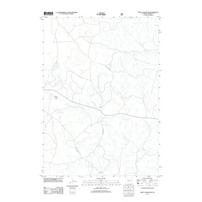
2012 Map of Piney Canyon NW
USGS Topo · Published 2012About this map
Burning Coal Draw defines the western portion of this Campbell County landscape, reflecting the region's geological and industrial character in the early 21st century. The map depicts a network of vital water sources and seasonal drainages, most notably Little Thunder Cr and its N Prong Little Thunder Cr. Named springs such as H A Spring and M W Spring suggest early agricultural or ranching improvements in an arid environment where water access dictated movement.
Find a feature on this map
9 named features on this map. Tap any name to fly to it.
Don’t see what you’re looking for? This feature index may not catch every label — zoom into the map to look around manually.
Map Details
Editions of this 2012 Piney Canyon NW Map
This is the sole edition of this map. No revisions or reprints were ever made.
Other maps of this area

1955 · Newcastle
USGS Topo · 1:250,000

1958 · Newcastle
USGS Topo · 1:250,000

1971 · Teckla
USGS Topo · 1:24,000

1971 · Piney Canyon NE
USGS Topo · 1:24,000

1971 · Open A Ranch
USGS Topo · 1:24,000

1971 · Reno Reservoir
USGS Topo · 1:24,000

1971 · Piney Canyon SW
USGS Topo · 1:24,000

1971 · Piney Canyon NW
USGS Topo · 1:24,000

1971 · Piney Canyon SE
USGS Topo · 1:24,000
1971 · Hilight
USGS Topo · 1:24,000