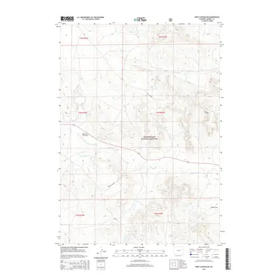
2015 Map of Piney Canyon NW
USGS Topo · Published 2015About this map
Thunder Basin National Grassland dominates this high plains landscape, where the drainage systems of Little Thunder Creek and the North Prong Little Thunder Creek have carved a series of draws and divides. The presence of Burning Coal Draw points to the subterranean energy resources characteristic of this region, while names like H A Divide and the H A Creek system reflect the ranching heritage that has long defined Campbell County. Navigated by early ranch-to-market routes such as Little Thunder Road and Reno Road, the territory remains largely open range punctuated by vital water sources like H A Spring and M W Spring. This documentation provides a clear look at the topography and land management boundaries within the national grassland just prior to recent developments.
Find a feature on this map
19 named features on this map. Tap any name to fly to it.
Don’t see what you’re looking for? This feature index may not catch every label — zoom into the map to look around manually.
Map Details
Editions of this 2015 Piney Canyon NW Map
This is the sole edition of this map. No revisions or reprints were ever made.
Other maps of this area

1955 · Newcastle
USGS Topo · 1:250,000

1958 · Newcastle
USGS Topo · 1:250,000

1971 · Teckla
USGS Topo · 1:24,000

1971 · Piney Canyon NE
USGS Topo · 1:24,000

1971 · Open A Ranch
USGS Topo · 1:24,000

1971 · Reno Reservoir
USGS Topo · 1:24,000

1971 · Piney Canyon SW
USGS Topo · 1:24,000

1971 · Piney Canyon NW
USGS Topo · 1:24,000

1971 · Piney Canyon SE
USGS Topo · 1:24,000
1971 · Hilight
USGS Topo · 1:24,000