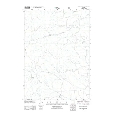
2012 Map of Piney Canyon SE
USGS Topo · Published 2012About this map
Rochelle Hills dominates the southern portion of this landscape, where the high ground gives way to a network of drainage systems feeding the surrounding basins. The area is defined by its complex hydrology, with Piney Cr carving through the Piney Canyon in the north while Horse Cr and Wildcat Cr drain the slopes to the south. This terrain has dictated the placement of a sparse road network, with routes like Rochelle Hills Rd and Piney Creek Rd following the contours of the land. The presence of Frog Cr and Keyton Cr suggests a region primarily used for open-range ranching and resource management, where water sources are the primary landmarks for navigation across the high plains of Campbell County.
Find a feature on this map
12 named features on this map. Tap any name to fly to it.
Don’t see what you’re looking for? This feature index may not catch every label — zoom into the map to look around manually.
Map Details
Editions of this 2012 Piney Canyon SE Map
This is the sole edition of this map. No revisions or reprints were ever made.
Other maps of this area

1955 · Newcastle
USGS Topo · 1:250,000

1958 · Newcastle
USGS Topo · 1:250,000

1971 · Fiddleback Ranch
USGS Topo · 1:24,000

1971 · Coal Bank Draw
USGS Topo · 1:24,000

1971 · Piney Canyon NE
USGS Topo · 1:24,000

1971 · Piney Canyon SW
USGS Topo · 1:24,000

1971 · Piney Canyon NW
USGS Topo · 1:24,000

1971 · Piney Canyon SE
USGS Topo · 1:24,000

1974 · Reno Junction
USGS Topo · 1:100,000

1979 · Newcastle
USGS Topo · 1:100,000