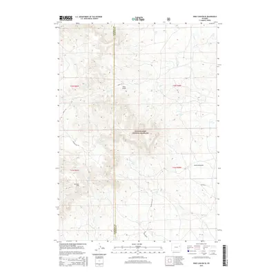
2015 Map of Piney Canyon SE
USGS Topo · Published 2015About this map
Thunder Basin National Grassland dominates this landscape on the border of Campbell and Weston counties, characterized by its complex drainage systems and varied terrain. The topographical detail reveals the winding path of Piney Cr through Piney Canyon, alongside other seasonal waterways like Frog Cr and Keyton Cr. This area is defined by the high ground of the Rochelle Hills and the depressions of Underwood Draw, illustrating the natural erosion patterns of the Powder River Basin. Though largely undeveloped, the map traces the vital rural infrastructure of the early 21st century, including Mackey Rd and Rochelle Hills Rd, which navigate the rugged contours of the grassland. The inclusion of the Campbell and Weston County line provides a precise reference for those studying land ownership and administrative boundaries in this part of Wyoming.
Find a feature on this map
18 named features on this map. Tap any name to fly to it.
Don’t see what you’re looking for? This feature index may not catch every label — zoom into the map to look around manually.
Map Details
Editions of this 2015 Piney Canyon SE Map
This is the sole edition of this map. No revisions or reprints were ever made.
Other maps of this area

1955 · Newcastle
USGS Topo · 1:250,000

1958 · Newcastle
USGS Topo · 1:250,000

1971 · Fiddleback Ranch
USGS Topo · 1:24,000

1971 · Coal Bank Draw
USGS Topo · 1:24,000

1971 · Piney Canyon NE
USGS Topo · 1:24,000

1971 · Piney Canyon SW
USGS Topo · 1:24,000

1971 · Piney Canyon NW
USGS Topo · 1:24,000

1971 · Piney Canyon SE
USGS Topo · 1:24,000

1974 · Reno Junction
USGS Topo · 1:100,000

1979 · Newcastle
USGS Topo · 1:100,000