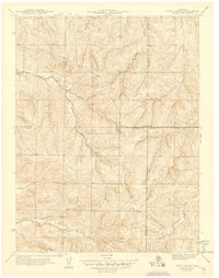
1942 Map of Piney Creek
USGS Topo · Published 1942About this map
Murphy Creek and Piney Creek headwater drainage systems define this landscape south of Denver, as surveyed by C. E. Blunt and other surveyors just before the United States entered the second World War. The area is characterized by a series of prominent drainages including Sampson Gulch and Coal Creek, which cut through the high plains terrain at the convergence of three Colorado counties. The map provides an intricate look at the boundary lines where Arapahoe Co Douglas Co meet, as well as the tri-point with Elbert Co. Sponsored in part by the Work Projects Administration, this survey preserves the rural character of the region before modern suburban expansion transformed the outskirts of the Denver metropolitan area, documenting the early road networks and natural watercourses like Sulphur Gulch and Baldwin Gulch.
Find a feature on this map
9 named features on this map. Tap any name to fly to it.
Don’t see what you’re looking for? This feature index may not catch every label — zoom into the map to look around manually.
Map Details
Editions of this 1942 Piney Creek Map
2 editions found

Other maps of this area

1890 · East Denver
USGS Topo · 1:125,000

1894 · Castle Rock
USGS Topo · 1:125,000

1913 · Castle Rock
USGS Topo · 1:125,000

1935 · East Denver Nos. 3 and 4
USGS Topo · 1:48,000

1939 · Coal Creek
USGS Topo · 1:24,000

1939 · Elizabeth
USGS Topo · 1:62,500

1940 · Piney Creek
USGS Topo · 1:24,000

1940 · Castle Rock
USGS Topo · 1:62,500

1941 · Fitzsimons
USGS Topo · 1:31,680

1942 · Parker
USGS Topo · 1:31,680