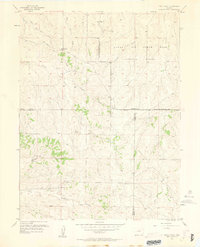
1957 Map of Piney Creek
USGS Topo · Published 1963About this map
The Lowry Air Force Base Bombing Range dominates the northern reaches of this Colorado landscape, defined by a rigid Military Reservation Boundary that carves through the undulating prairie. Surveyed in the mid-1950s, the terrain is characterized by a series of north-flowing drainages including West Toll Gate Creek, East Toll Gate Creek, and Murphy Creek. These watercourses create a distinct dendritic drainage pattern across the high plains southeast of Denver.
Find a feature on this map
22 named features on this map. Tap any name to fly to it.
Don’t see what you’re looking for? This feature index may not catch every label — zoom into the map to look around manually.
Map Details
Editions of this 1957 Piney Creek Map
3 editions found
Other maps of this area

1890 · East Denver
USGS Topo · 1:125,000

1894 · Castle Rock
USGS Topo · 1:125,000

1913 · Castle Rock
USGS Topo · 1:125,000

1935 · East Denver Nos. 3 and 4
USGS Topo · 1:48,000

1939 · Coal Creek
USGS Topo · 1:24,000

1939 · Elizabeth
USGS Topo · 1:62,500

1940 · Piney Creek
USGS Topo · 1:24,000

1940 · Castle Rock
USGS Topo · 1:62,500

1941 · Fitzsimons
USGS Topo · 1:31,680

1942 · Parker
USGS Topo · 1:31,680