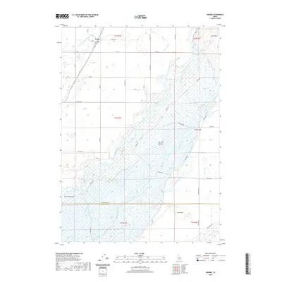
2020 Map of Pingree
USGS Topo · Published 2020About this map
Fort Hall Bottoms dominates the central portion of this landscape, where the Snake River branches into a complex network of wetlands and seasonal channels. This intricate riparian system is defined by numerous smaller watercourses such as Jeff Cabin Cr and Big Jimmy Creek, which thread through the floodplain before reaching the main stem. The higher ground surrounding the river valley is marked by distinctive geological features like Ferry Butte in the northeast and Cedar Butte to the southeast, providing sharp elevation changes against the flat wetlands.
Find a feature on this map
50 named features on this map. Tap any name to fly to it.
Don’t see what you’re looking for? This feature index may not catch every label — zoom into the map to look around manually.
Map Details
Editions of this 2020 Pingree Map
This is the sole edition of this map. No revisions or reprints were ever made.
Other maps of this area

1934 · Michaud
USGS Topo · 1:62,500

1937 · Pocatello
USGS Topo · 1:48,000

1937 · Michaud
USGS Topo · 1:62,500

1940 · Blackfoot
USGS Topo · 1:62,500

1943 · Blackfoot
USGS Topo · 1:62,500

1944 · Pocatello
USGS Topo · 1:62,500

1954 · Pocatello
USGS Topo · 1:250,000

1955 · Springfield NW
USGS Topo · 1:24,000

1955 · Rockford
USGS Topo · 1:24,000

1955 · Pingree
USGS Topo · 1:24,000