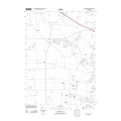
2012 Map of Pingree Grove
USGS Topo · Published 2012About this map
Pingree Grove serves as a central hub in this Kane County landscape, where the suburban expansion of the early 21st century meet the traditional agricultural patterns of northern Illinois. The drainage of the S Br Kishwaukee River and Tyler Cr structures the terrain, supporting a network of small settlements like Allens Corners, Starks, and Plato Center. For local historians and genealogists, the map preserves the locations of vital community landmarks, including the North Plato Cem, Doty Cem, and the Washington Memorial Cem. The presence of several small airfields, such as Olson Airport and Reid RLA Airport, alongside residential developments like Hidden Lakes and Tamara Heights, illustrates the mid-century to modern transition from purely rural farming to a more diverse residential and commuter-oriented geography.
Find a feature on this map
119 named features on this map. Tap any name to fly to it.
Don’t see what you’re looking for? This feature index may not catch every label — zoom into the map to look around manually.
Map Details
Editions of this 2012 Pingree Grove Map
This is the sole edition of this map. No revisions or reprints were ever made.
Other maps of this area

1925 · Elgin
USGS Topo · 1:62,500

1932 · Geneva
USGS Topo · 1:62,500

1937 · Sycamore
USGS Topo · 1:62,500

1938 · Genoa
USGS Topo · 1:62,500

1940 · Elgin
USGS Topo · 1:62,500

1948 · Geneva
USGS Topo · 1:62,500

1949 · Geneva
USGS Topo · 1:24,000

1954 · Rockford
USGS Topo · 1:250,000

1955 · Rockford
USGS Topo · 1:250,000

1958 · Aurora
USGS Topo · 1:250,000