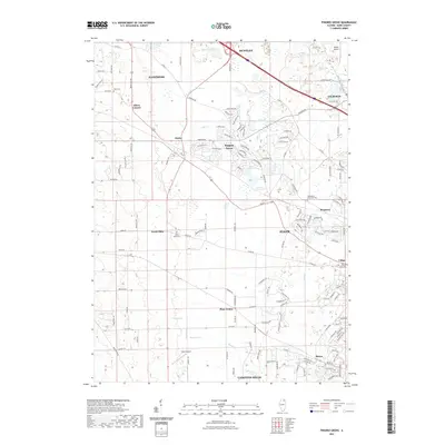
2021 Map of Pingree Grove
USGS Topo · Published 2021About this map
Pingree Grove and the surrounding Kane County countryside appear here as a landscape in transition, where residential development meets established agricultural roots. The map traces the winding paths of the S Br Kishwaukee River and Tyler Cr, which drain the varied terrain near Huntley and Hampshire. Local history is anchored by several small burial grounds, including Doty Cem and the Washington Memorial Cem, reflecting generations of settlement in this part of Illinois. Significant aviation landmarks like Koppie Airport and Olson Airport dot the landscape, while long-standing communities such as Plato Center and North Plato maintain their identities amidst the expanding outskirts of Elgin. The intricate network of county roads, including Co Rd 21 and Brier Hill Rd, provides a clear view of the rural infrastructure that has connected these crossroads for decades.
Find a feature on this map
134 named features on this map. Tap any name to fly to it.
Don’t see what you’re looking for? This feature index may not catch every label — zoom into the map to look around manually.
Map Details
Editions of this 2021 Pingree Grove Map
This is the sole edition of this map. No revisions or reprints were ever made.
Other maps of this area

1925 · Elgin
USGS Topo · 1:62,500

1932 · Geneva
USGS Topo · 1:62,500

1937 · Sycamore
USGS Topo · 1:62,500

1938 · Genoa
USGS Topo · 1:62,500

1940 · Elgin
USGS Topo · 1:62,500

1948 · Geneva
USGS Topo · 1:62,500

1949 · Geneva
USGS Topo · 1:24,000

1954 · Rockford
USGS Topo · 1:250,000

1955 · Rockford
USGS Topo · 1:250,000

1958 · Aurora
USGS Topo · 1:250,000